Ocean Science Trust
  • About Us
    • What We Stand For
    • Our Link to California
    • Our People
    • Accountability
    • Our Values
      • Land Acknowledgement
  • Our Work
    • Our Core Functions
      • Supporting Graduate Education
      • Developing Science Solutions
      • Delivering Science Advice to Policymakers
      • Legislative Science Services
        • California Ocean Bill Tracker
    • Our Programmatic Priorities
      • Supporting accelerated, responsible offshore wind energy development
      • Unlocking the Potential of Insurance for Coastal Resilience
      • Building Climate Resilience in California’s Fisheries
      • Science Diplomacy on Marine Carbon Dioxide Removal (mCDR)
    • Our Approach
  • Connect
    • Careers
    • Funders
    • Contact Us
  • Stories
  • Keep in Touch
  • Donate
  • Search

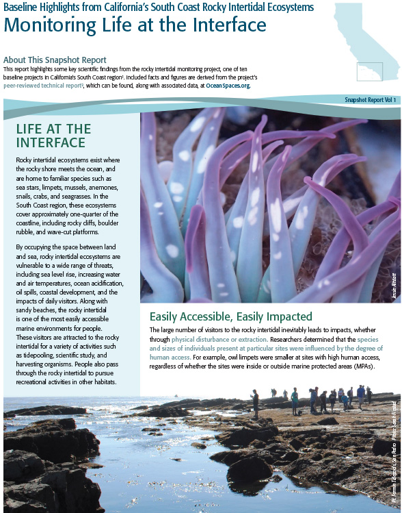
South Coast Snapshot Report: Rocky Intertidal

October 31, 2017/in Reports Marine Protected Areas /by hyperadmin
Tags: Marine Protected Areas Baseline
https://www.oceansciencetrust.org/wp-content/uploads/2017/09/rocky-intertidal-snapshot-1.jpg 749 588 hyperadmin https://live-oceansciencetrust.pantheonsite.io/wp-content/uploads/2020/11/Horizontal_Transparency_cropped-300x70.png hyperadmin2017-10-31 19:32:422018-12-11 18:54:16South Coast Snapshot Report: Rocky Intertidal
You might also like
Evaluating California’s Marine Protected Area Network
State of the California North Central Coast
North Coast Snapshot: Estuaries
State of the California North Central Coast: Key Findings
Assessing Water Quality in South Coast MPAs (Southern California Bight Regional Monitoring Program)
Assessing Physical Conditions of South Coast MPAs (Southern California Coastal Ocean Observing System, Coastal Data Information Program)
Summary of South Coast Physical Conditions (2012-2015)
State of the California North Coast
  • Home
  • About Us
  • Our Work
  • Connect
  • Stories
  • Contact Us
  • Careers
  • Support Our Work

Sign up for our newsletter

Scroll to top